Nashville East Bank

Nashville East Bank
Program Management for the Redevelopment of 550 Acres Guided by the Imagine East Bank Vision Plan
- Coordinated delivery of 550-acre redevelopment from vision through implementation
- Creation of a GIS-based planning tool to improve construction scheduling, prevent conflicts and reduce rework
- Development of an innovative financial modeling tool to avoid funding gaps and support long-term financial sustainability
- Detailed oversight of resilient infrastructure and floodplain management strategy
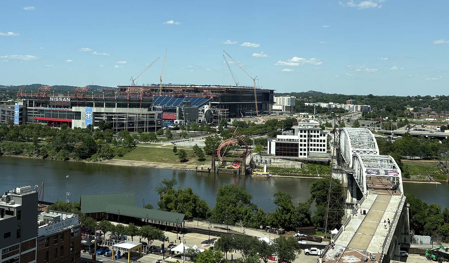
For decades, Nashville’s East Bank was characterized by underutilized and disconnected parcels, aging infrastructure and limited public access to the Cumberland River. Despite its proximity to the city’s entertainment and central business districts, the East Bank remained disconnected in part because of its flood prone elevations. At the same time, rapid population growth intensified needs for housing, transportation, utilities and public spaces.
To fully meet the opportunities afforded by the East Bank, particularly after plans for Nissan Stadium emerged, Metro Nashville initiated the Imagine East Bank vision plan in 2021. The ambitious and aspirational initiative aims to transform the area — bordered by the Cumberland River, Interstate 24 and Interstate 65 — into equitable and connected neighborhoods with safe and simple multimodal access and renewed respect for the river.
HDR was selected as program manager in October 2023 to implement the Imagine East Bank vision plan. Working in partnership with the East Bank Development Authority (EBDA) — established to lead and oversee redevelopment — we’re helping structure, coordinate and advance the planning, engineering, and delivery of both private and public projects.
Today, our combined multidisciplinary team supports program controls, scheduling, cost estimating, utility coordination, risk management, planning, preliminary engineering, design, environmental review, quality standards, financial planning, procurement and construction oversight.
Coordinating a Complex Program
Early program management focused on developing public infrastructure master plans and advancing design to 30% within the 130-acre Metro-owned Central Waterfront District, surrounding the new Nissan Stadium. Work included planning and engineering for roadways, utilities, stormwater, pump stations, parking and multimodal access, supporting a 30-acre Initial Development Area, the new Tennessee Performing Arts Center, and parks and greenways.
With collaboration among Metro departments, private developers and state partners critical to delivering the East Bank, we facilitate meetings in partnership with EBDA to align stakeholder priorities and guide decision-making to advance major projects, including roadway connections linking the East Bank to surrounding neighborhoods.
GIS-Driven Planning and Visualization
A key early challenge was finding ways to functionally combine the different methods that various developers, agencies, and utilities used to track their schedules and timelines. Lack of alignment posed risk to the program in what was an already constrained environment with multiple construction projects and various community activities.
Our geographic information system (GIS) professionals created a planning and visualization tool that integrated land parcels, roadway and utility projects, construction schedules, special events and staging areas across all 550 acres into a single platform. Stakeholders can view month by month, or even years into the future, to identify conflicts, gaps and overlaps in schedules before they become problems. For example, the tool helps to prevent conflicts, such as a parcel being labeled as ready for construction on one schedule while simultaneously available for event parking in another. It also supports proactive decisions, including coordinating utility installations with road construction to save time and reduce rework.
Aligning Funding and Delivery
Detailed financial planning and cost management have been critical to the EBDA’s work. To align funding sources with the program schedule, prevent funding shortfalls, improve stakeholder transparency and secure long-term financial sustainability, our economics and finance team developed an innovative financial planning model.
Originally created as a basic spreadsheet to support initial capital spending plan requests for Metro, the model continues to grow with input from the EBDA to continuously mature with the program. It now tracks secured and obligated funding, specific fund uses, month-over-month cash flow, future project funding needs and potential revenue streams, such as leases, rent and tax revenue, supporting EBDA in eventually becoming self-sustaining.
Advancing Flood Resilience
Much of the East Bank sits within a floodplain, and engineering efforts throughout the program have been focused on redeveloping areas to be more resilient following the historic 2010 flood, a 1,000-year storm event.
Our flood analysis experts have reviewed flood models and guided the design of new public infrastructure to better manage future flooding. Grading plans, street profiles, utilities and stormwater infrastructure are being designed to be more resilient during flood events. Parks and riverfront greenways are being designed to with flood resilience in mind, helping to reduce the risk of damage to East Bank development during high river levels.
Building on Success
Construction and completion of a series of projects will continue over many years. Numerous key infrastructure investments are anticipated to be in place ahead of Nissan Stadium hosting the Super Bowl in 2030 as work continues throughout the rest of the East Bank.


