Red Line Commuter Rail

Red Line Commuter Rail
Planning and Designing Commuter Service on an Existing Rail Line in Charlotte, North Carolina
- Updated 15-year-old design by evaluating existing corridor conditions
- Evaluation and refinement of station locations with conceptual layouts and typology framework
- Developed conceptual design for a new vehicle maintenance facility
- Supported O-Line purchase by establishing corridor management processes
- Identified utility and environmental risks early to avoid long-term delivery challenges
The Red Line Commuter Rail project has been part of Charlotte’s long-range vision for decades. When completed, the line will provide a north-south transit connection between Uptown and communities in northern Mecklenburg and southern Iredell Counties. Continued population growth and development have increased congestion on roadways, including Interstate 77, reinforcing the need for a reliable and efficient transportation alternative in the state's largest metro area.
In 2008, HDR designed track and grade crossings to 90% and stations to 30% for a previous iteration of the project. Initially planned along Norfolk Southern’s O-Line, a passenger rail policy change at the railroad paused the project until the City of Charlotte agreed to purchase the 25-mile right of way in 2023. HDR was then hired by the City and Charlotte Area Transit System (CATS) to lead the design to the 15% level. Our work has included preliminary engineering, station area planning, public and stakeholder engagement, vehicle maintenance facility design and development of an environmental red flag document, positioning us to extend services into environmental permitting and design to 30%.
Reimagining the Corridor
Our team supported the city during negotiations of the 2024 purchase agreement with the railroad by reviewing proposed language related to operating conditions and service limits. We also worked with CATS to create an online portal to help the agency track, review, and approve agreements and manage assets on the purchased O-Line.
An understanding of the conditions on the purchased corridor was critical. A structural analysis of existing bridges operated by Norfolk Southern helped us evaluate load capacities and determine where replacement might be required. Utilities were also assessed across the corridor. By identifying hundreds of potential utility conflicts early, the project team provided CATS with a roadmap for proactively addressing relocations rather than reacting to them during final design and construction.
This improved understanding of the current corridor was key to updating the Red Line’s 15-year-old plans. Ten station locations identified in the original design were reevaluated in coordination with CATS and corridor communities. A station typology framework was created to guide future land use and multimodal access considerations around each station.
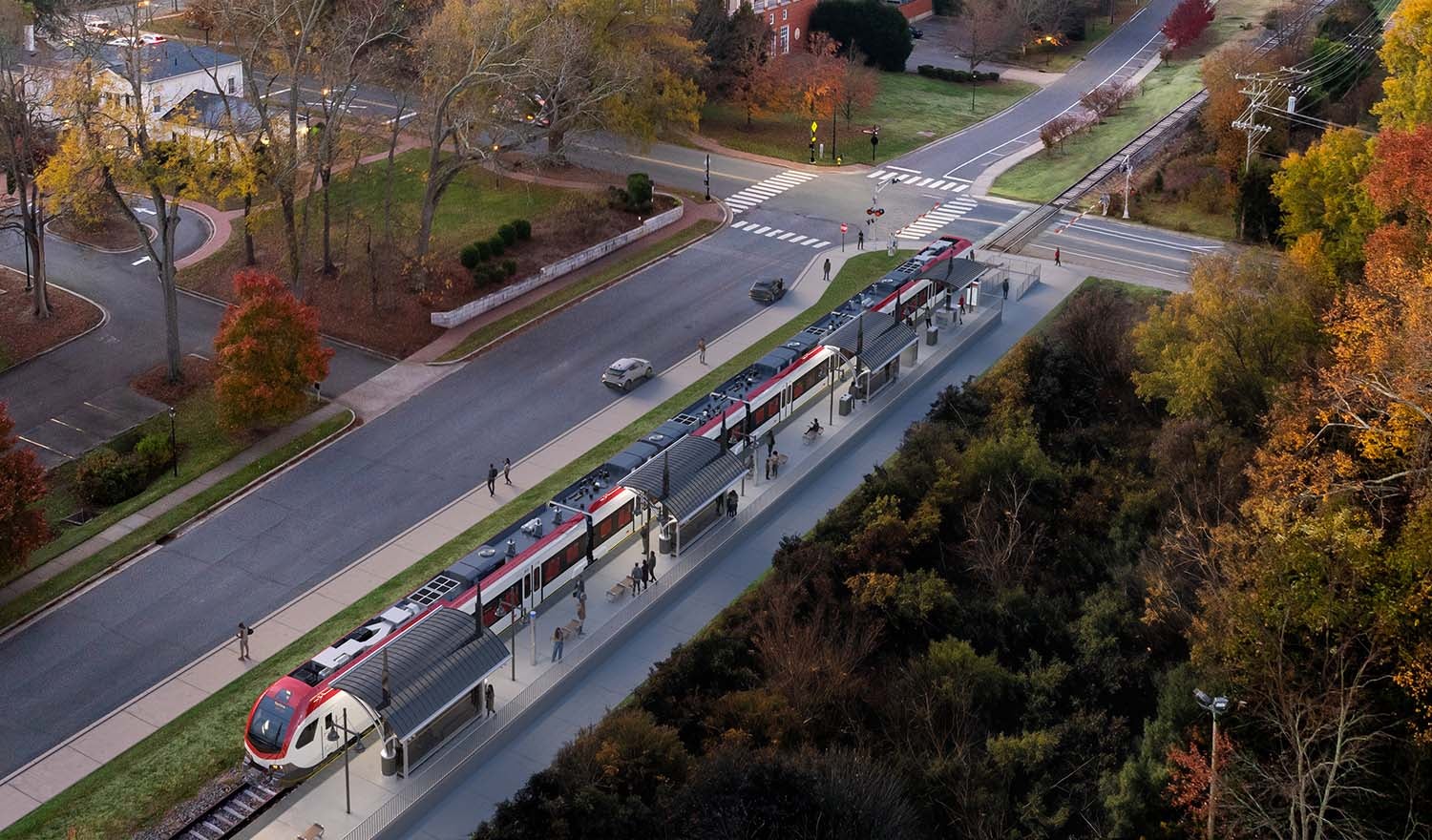
We evaluated multiple alignment and terminus options to efficiently connect the Red Line to Uptown and the planned Charlotte Gateway Station. Using a structured evaluation matrix considering constructability, operations, cost and right-of-way constraints, we developed alternatives and helped CATS identify a preferred alignment for the early design.
Optimizing Service and Operations
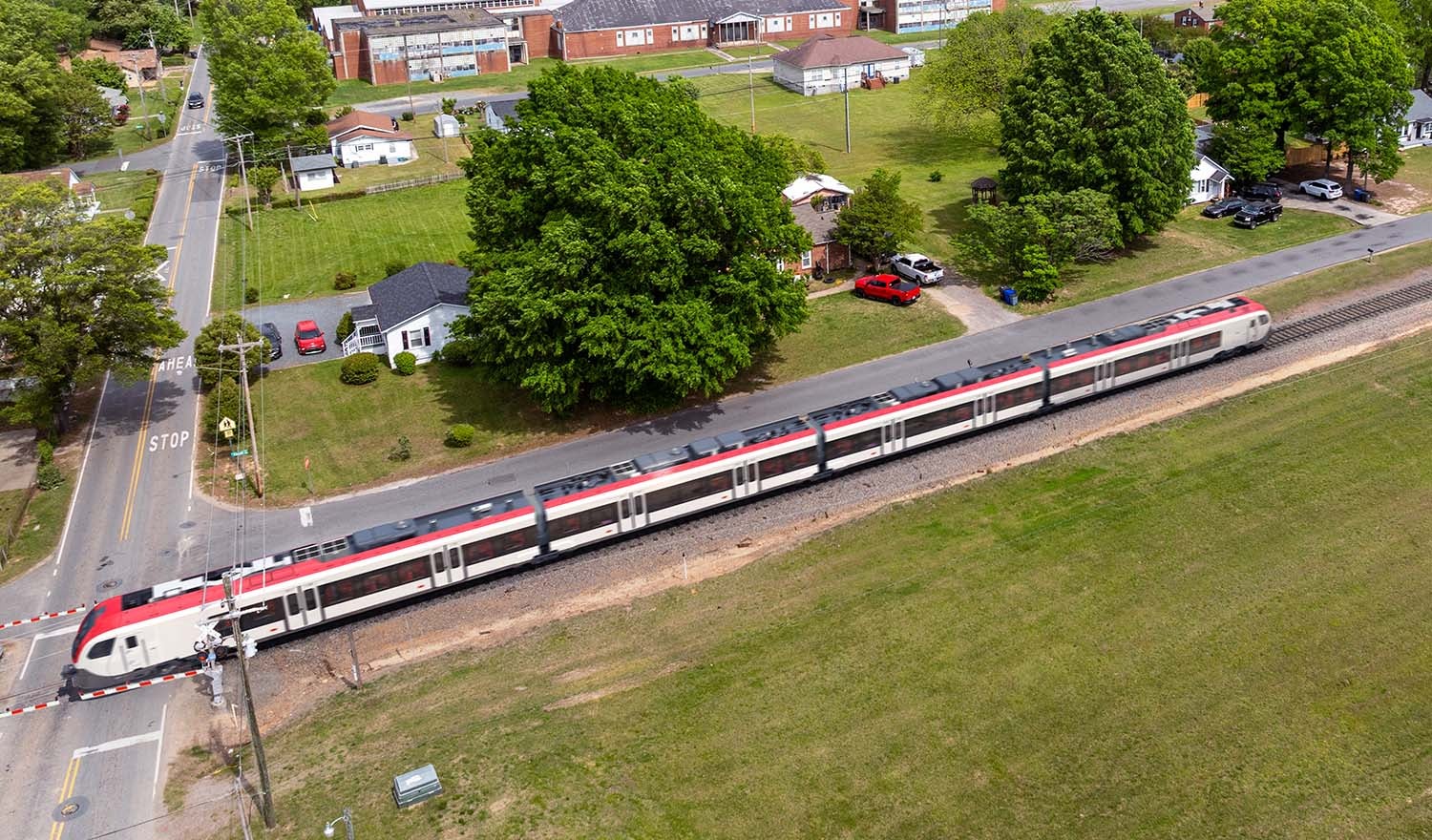
Under the finalized service plan, the corridor will accommodate freight and passenger service. Our rail modelers evaluated the proposed service levels of both types of trains and the interactions between them. The analysis confirmed that the planned passenger service — 21 weekday round trips, or 42 trains per day — could operate reliably with the infrastructure identified at the 15% level design.
When the originally planned vehicle maintenance facility site was no longer feasible, the team established a comprehensive site selection framework to compare alternatives. Using criteria established with the City of Charlotte, CATS and surrounding municipalities, each site was weighed and ranked, supported by site visits and basic operational test fit layouts by our team. This process narrowed the options to a preferred site.
An operations and maintenance cost estimate based on the proposed level of service provided CATS with an understanding of long‑term operating needs and supports future discussions about funding and delivery.
Driving Engagement
Community and stakeholder engagement is essential to this very public project. Our strategic communications team developed a public involvement plan and supported CATS with facilitating public meetings, stakeholder interviews and workshops to gather feedback. An animated explainer video and a public-facing existing conditions Story Map helped convey the complex planning concepts and existing conditions. We also completed a geospatial community analysis to identify underserved and underrepresented populations along the corridor.
With early planning completed, environmental documentation and design to 30% are estimated to begin in the summer of 2026.


