El Camino Real Corridor Visioning & Analysis

El Camino Real Corridor Visioning & Analysis
Addressing the Housing Supply Crisis in Silicon Valley
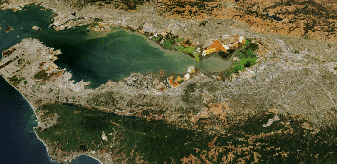
Across California, the subject of housing cost is front and center. Nowhere is this issue felt more acutely than the San Francisco Bay area, a region that added 11 jobs for every one home since 2010. This extreme mismatch in jobs and housing growth has caused the median home price in the Bay Area to rise to $934,000 — with San Francisco at $1.4 million and Silicon Valley enclave Palo Alto at a staggering $3.1 million. Moreover, rents in San Francisco have risen more than 60% since 2012. In an effort to better understand how and where our HDR | Calthorpe team can address California’s housing supply crisis, UrbanFootprint explored the impacts of different approaches to new housing development. We aimed our sites along El Camino Real, a 45-mile-long critical artery at the heart of Silicon Valley.
While El Camino changes in character along the corridor, it is mostly suburban in nature throughout its length. The area within a half mile of the corridor is lined by more than 2,000 acres of relatively low intensity commercial development and nearly 100,000 office jobs. It is home to more than 55,000 single family residences and another 90,000 apartments and townhomes. In addition to evaluating housing potential, we examined the costs and benefits of infill housing, revealing critical energy, water, transportation, and cost challenges. This process also considered how new innovations in transit and mobility, such as Autonomous Rapid Transit technology, would affect communities and housing needs.
Scenario-Based Solutions
What if single-use commercial strip development was replaced with mixed-use buildings and housing? How much housing could fit on the corridor in four story buildings? What if we focused more intense development around rail stations? For this study, we stayed away from redeveloping or upzoning major office developments, instead focusing on how much more housing could be accommodated in existing commercial and residential uses. To answer these questions, we considered a range of scenarios using an UrbanFootprint analysis:
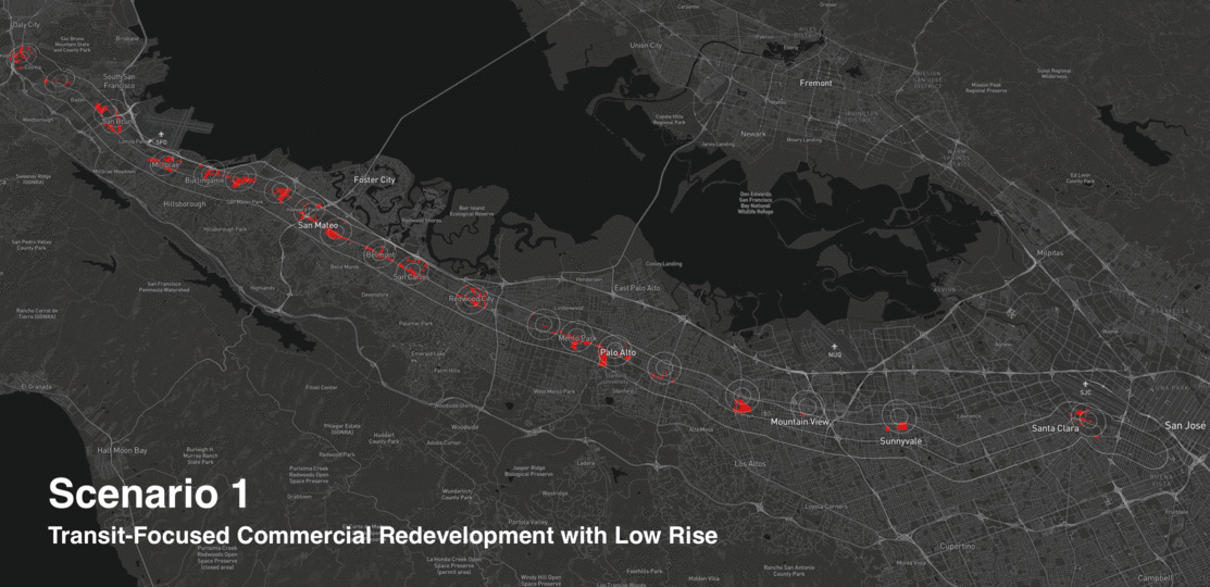
- Transit-Focused Commercial Redevelopment with Low Rise: Low-intensity commercial parcels within a half mile of a rail stop and El Camino Real converted to low-rise (3-5 story) mixed-use development.
- Transit-Focused Commercial Redevelopment with Low and Mid Rise: Low-intensity commercial parcels within a quarter mile of a Caltrain stop and El Camino Real converted to mid-rise (7-10 story) mixed-use development. Those within a half mile of a rail stop and El Camino Real converted to low-rise mixed use.
- Corridor-Wide Commercial Redevelopment: Low-intensity commercial parcels within a half mile of El Camino Real are converted to low-rise mixed-use development.
- SB 827 Residential Upzone: This scenario presents the theoretical maximum housing production possible under SB 827 (April 2018) amendment. Residential parcels within a quarter mile of transit areas are upzoned to five stories, while those within a half mile are upzoned to four-story residential and mixed-use development.
At the end of our UrbanFootprint analysis, we discovered 250,000 new dwellings are possible on the low-density commercial land lining the boulevard. In addition, our teams found that enhancing a typical Bus Rapid Transit (BRT) system with autonomous buses can reduce operation costs by 48% and increase average speeds by 27%. This technology could trigger a revolution in TOD planning, catalyzing infill while spreading a new form of transit that is more affordable and more attractive to riders.
Sustainable Living
El Camino, and corridors like it, have the potential to take a substantial dent out of the housing supply crisis in California. But what are other impacts of placing more housing on such corridors, closer to job centers and transit networks? What if housing were built in other Bay Area locations, perhaps across the Bay in Alameda County where many Silicon Valley workers commute from every day? We compared the impacts of an average Alameda County household with those in the El Camino housing scenarios and the differences are substantial.
Compared to the average Alameda County household, households in the El Camino Scenario 3 (Corridor-Wide Scenario Redevelopment):
- Consume nearly 40% less water per year, which adds up to 5.2 billion gallons, the water used by 70,000 Bay Area homes per year.
- Use 13% less energy in their homes, adding up to the energy used by more than 25,000 homes in a year.
- Drive 33% fewer miles per year, equivalent to taking 93,000 cars off the road each year.
- Produce 45% less greenhouse gas emissions, which adds up to the equivalent of the emissions produced by 108,000 Bay Area households.
- Save $3,100 per year in transportation costs, adding up to more than $730 million per year for all the households in Scenario 3.
By envisioning potential solutions to improve housing supply and analyzing their outcomes, the El Camino Real Corridor Visioning and Analysis process was able to pinpoint changes that would be most impactful in providing affordable, accessible, and sustainable housing in a rapidly growing region.


