I-10 Wild Horse Pass Corridor Project

I-10 Wild Horse Pass Corridor Project
Photos courtesy of Arizona Department of Transportation.
Program Manager and General Engineering Consultant on a 26-Mile Widening of Interstate Near Phoenix
- Rebuilding trust through transparency, early engagement and cultural coordination during environmental review and preliminary design
- Reorganizing program delivery into four construction projects to align with available funding and resources
- Coordinating construction sequencing to keep I-10 open throughout the project while adhering to contractor schedules
Interstate 10 links Arizona’s two largest metropolitan areas — Phoenix and Tucson. Along this route is the 26‑mile Wild Horse Pass Corridor, located entirely within the Gila River Indian Community. It is the last remaining segment of I-10 between the two cities with only two lanes in each direction, creating a bottleneck that causes congestion, delays and safety concerns for freight and passenger traffic.
To address these issues, the Arizona Department of Transportation (ADOT) prioritized the I-10 Wild Horse Pass Corridor Project. The nearly $1 billion program will widen and modernize the entire segment between Loop 202 and State Route 387. HDR has a long history with the corridor, having designed an original portion of I-10 in the 1960s. In 2019, we were selected to complete the preliminary design and Environmental Assessment. Our role expanded in 2022 to become program manager and general engineering consultant (GEC), supporting ADOT throughout the multi-year effort with construction management, public involvement, procurement and environmental compliance monitoring.
Fostering Collaboration
For many years, efforts to improve this portion of I-10 stalled over disagreements between the ADOT and the Gila River Indian Community. When the project was restarted in 2019, rebuilding trust became a priority. Working as an extension of ADOT staff and alongside the Maricopa Association of Governments, our project team supported an approach focused on full transparency and detailed engagement with the community.
During the environmental assessment, we assisted with public meetings and coordinated discussions between ADOT technical teams, tribe representatives and the public in shaping design concepts in the alternatives analysis. Two EAs were completed: one for the full corridor and a second for a new traffic interchange to support tribal economic development goals. Cultural resources coordination was a major part of both efforts. Our cultural resource professionals worked closely with the tribe’s cultural resources office on surveys, recovery planning and monitoring of sensitive areas. All project personnel also complete cultural sensitivity training led by the tribe. We’re also monitoring the implementation of mitigation measures outlined in the EA.
Supporting Right of Way and Project Delivery
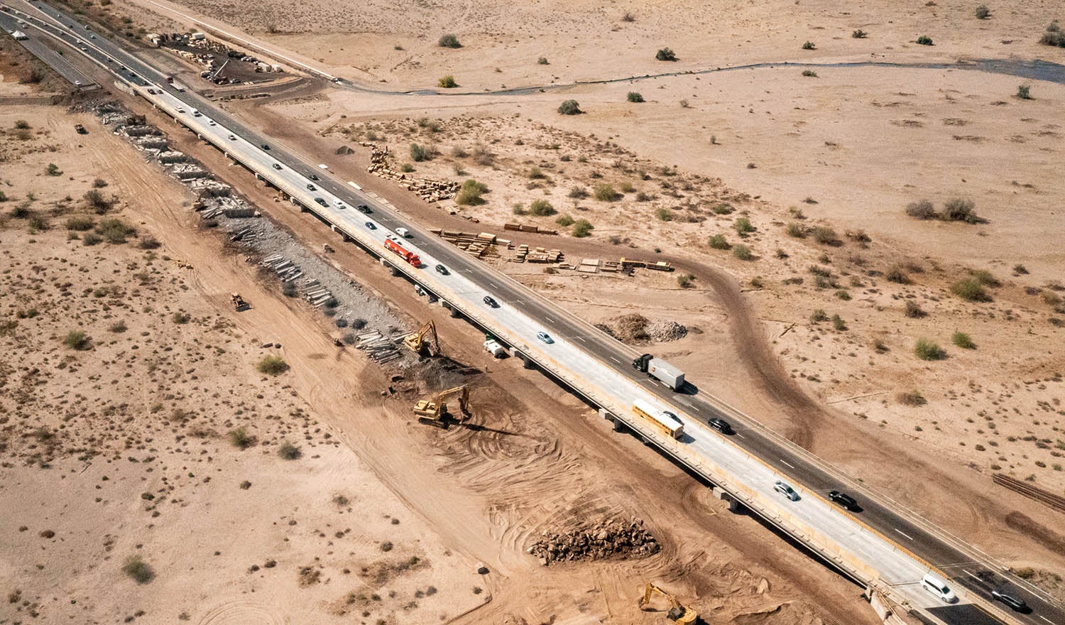
The work was initially conceived as a single design-build project. To maintain momentum as environmental work progressed, we collaborated with ADOT to reassess the delivery approach and better align it with available funding and resources. As a result, the project team restructured the corridor into four construction projects using both design-build and design-bid-build methods. Our team completed the preliminary design for all four segments and prepared the procurement documents for the design-build package. This phased strategy allowed design, right of way acquisition and construction to proceed as resources became available.
The four segments include:
- I-10 Bridges Over the Gila River – Replacement of existing two-lane river bridges with wider three-lane bridges, full-width shoulders, updated approaches and deeper foundations
- I‑10 Gas Line Road to South of SR 387 – Addition of a third lane, rebuilding of interchanges and bridges, removal of an older bridge and installation of freeway management technology
I‑10 Gila River Indian Community – Widening with general‑purpose and HOV lanes, upgrading bridges and interchanges, constructing a major flyover and a new traffic interchange, and installing lighting and freeway management technology - I‑10 Gila River to Gas Line Road – Addition of a third lane, reconstructed bridges, an interchange reconfiguration, and freeway management technology
The acquisition of right of way for each segment has presented challenges. In addition to running through tribal land, the corridor goes through allotted plots. Leasing this land requires signatures from half of allottees, which can include hundreds or even thousands of heirs. Supporting ADOT and the tribe, we drew on Native American and tribal right of way experience from our team in Alaska to establish schedules, procedures and outreach materials, as well as best practices for tracking acquisition progress.
Modeling for Resiliency
With sediment buildup and erosion affecting the existing I-10 Gila River Bridges, our team developed hydraulic modeling to better understand the issue and inform future design decisions. Through an SRH-2D model, we assessed various bridge configurations, including raising and widening the bridge, as well as led scour assessments, sediment yield analysis and a climate change analysis of the watershed to evaluate the long-term resiliency.
This model was the largest two‑dimensional analysis commissioned by ADOT and served as a major tool for shaping the bridge’s final design.
Coordinating Construction
As construction ramps up, coordination across the four projects and teams has become important. In 2026, as many as three projects may be actively in progress at the same time. Since full freeway closures are not allowed, the interstate must remain open with all four lanes open during the day, with only nighttime closures permitted. In addition, detours onto tribal roads were avoided. To support these restrictions, our construction oversight team leads monthly meetings bringing contractors together to review look-ahead schedules, lane restrictions and anticipated closures. We’re also working with ADOT to align traffic control efforts across the various projects to create consistent expectations among teams and minimize disruptions for drivers.
Construction across all four projects is estimated to be completed in 2029, with some work finishing earlier.


